 |
 |
|
|
|
|
|
|
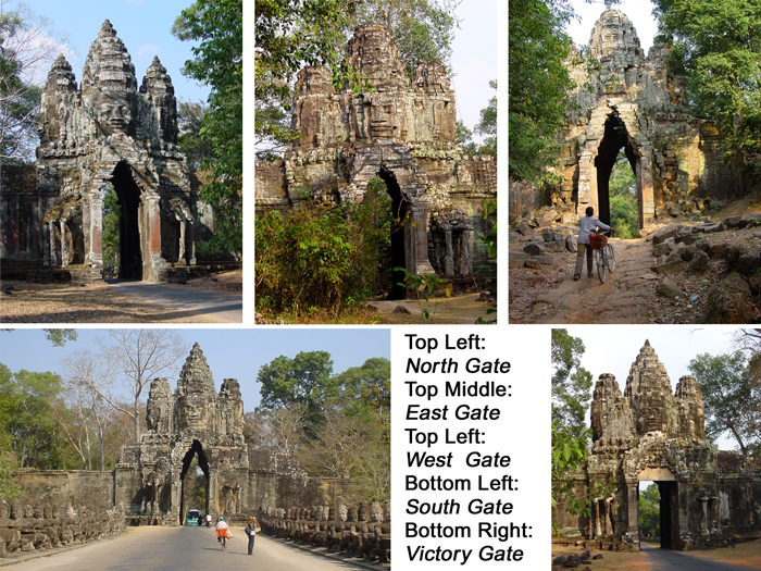
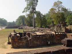
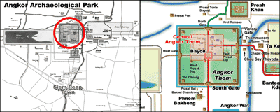 Angkor
Thom (Big Angkor) is a 3km2 walled and moated royal city and was the
last capital of the Angkorian empire. After Jayavarman VII recaptured
the Angkorian capital from the Cham invaders in 1181, he began a massive
building campaign across the empire, constructing Angkor Thom as his new
capital city. He began with existing structures such as Baphuon and
Phimeanakas and built a grand enclosed city around them, adding the
outer wall/moat. He then constructed some of Angkor's greatest temples
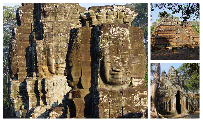
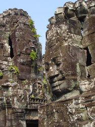
including his state-temple, Bayon, set at the center of the city. There
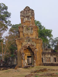
are five entrances (gates) to the city, one for each cardinal point, and
the victory gate leading to the Royal Palace area. Each gate is crowned
with 4 giant faces. The South Gate is often the first stop on a tour. Angkor
Thom (Big Angkor) is a 3km2 walled and moated royal city and was the
last capital of the Angkorian empire. After Jayavarman VII recaptured
the Angkorian capital from the Cham invaders in 1181, he began a massive
building campaign across the empire, constructing Angkor Thom as his new
capital city. He began with existing structures such as Baphuon and
Phimeanakas and built a grand enclosed city around them, adding the
outer wall/moat. He then constructed some of Angkor's greatest temples
including his state-temple, Bayon, set at the center of the city. There
are five entrances (gates) to the city, one for each cardinal point, and
the victory gate leading to the Royal Palace area. Each gate is crowned
with 4 giant faces. The South Gate is often the first stop on a tour. |
|
Terrace of the Leper King |
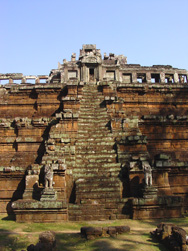
Phimeanakas |
Prasat Suor Prat |
|
Bayon |
Bayon |
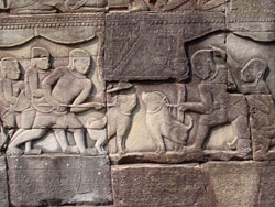
Terrace of the Elephants |
|
Gates of Angkor Thom
|