|
Cambodia: Map Index
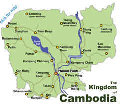
Cambodia
Maps
Cambodia Map
Cambodia Map:
Large
Cambodia Map:
Simple
Cambodia: Overland Travel
Cambodia: Provinces
Cambodia: Road Map of Southern Coast
Cambodia:
Map of Southern Coast in the Bokor-Kampot-Kep area
Area
Surrounding Phnom Penh
Western Cambodia: Remote Temples
Tonle
Sap Lake Map
Phnom Penh
Maps
The main body of Phnom Penh sits along the west side of the Tonle Sap and Bassac Rivers. The airport is at the western edge of town, about 9km (40-60 minutes) from town center. Most in-city points of interest lie within 10-20 minutes of each other. Hotels, restaurants and shops are spread across the city, though there is a greater concentration toward the center of the town, especially near and along the riverfront. Public transportation including tuk-tuks, taxis, mototaxis and cyclos are readily available citywide making it easy to catch transport from one site to the next.
Map
of Phnom Penh City - This map covers the main body of Phnom Penh
City.
Area Map: Street 178 and 172 Area - The blocks north of the Royal Palace are populated with souvenir shops and galleries, restaurants and cafes, bars, hotels and guesthouses. Street 178 is known as ‘Art Street’ for the local art galleries that line the road near the National Museum. Over the last few years Street 172, a block north of 178, has turned into a busy and popular traveler/backpacker street lined with bars, restaurants, convenience stores and inexpensive guesthouses...
Area
Map: Boeung Keng Kang 1 - The Independence Monument area and Boeung Keng Kang (BKK1) has been considered the foreigner’s quarter since the 80s. Bordered by Sihanouk, Mao Tse Tung, Monivong and Norodom Boulevards, BKK1 is home to many NGOs and international organizations as well as apartments, hotels and other businesses catering to expats and tourists. Accommodations in the area tend to be lower mid-range hotels and upscale boutique places...
Area Map: Street 240 near the Royal Palace - The tree shaded
Street 240 next to the Palace is home to a small collection of boutiques and shops offering Cambodian silk fashions, art and handicrafts as well as a couple restaurants/bars, wine shops, a bookstore and a travel agent...
Area Map: Riverfront dining and shopping area - The Riverfront area from Street 104 to the Royal Palace is popular with locals and tourists alike. In addition to harboring several of the city’s most popular sights including the Royal Palace and the the National Museum, the riverfront road, Sisowath Quay, is lined with restaurants and bars, hotels, souvenir shops, spas, travel agents and more...
Area
Map: Street 51 area - Well
after dark, Street 51 is the
place to be. Anchored by the famous Walkabout Hotel, Shanghai and the Heart of Darkness bar, nearly a dozen bars and clubs
and a couple of hotels are concentrated into a few blocks along Street
51...
Area Map: Street 104 near the riverfront - The
Street 104 area, just off of Sisowath Quay opposite the passenger
port at the northern end of the riverfront promenade, is the
riverfront’s ‘Pub Street,’ harboring a growing cluster of pubs and
hostess bars, a few of mid-range hotels and a couple of the riverfront’s
better restaurants...
Sabay Sabay Street - A wide array of vibrant and welcoming restaurants, clubs, bars, hotels and shops line the newly created Sabay Sabay Street, located in the heart of Phnom Penh. The street, whose name fittingly translates to "Happy Happy Street" also features several LGBTI-friendly venues, and has became a hub of activity for tourists and locals looking to dine, dance, shop and socialize. Don't miss the drag shows and live performances, including the new Sabay Sabay Cabaret.....
Phnom Penh City Cyclo/Walking Tour Map The ‘City Center’ - roughly bordered
between the river and Monivong Blvd and from Wat Phnom to Sihanouk
Blvd. - is the oldest section of the city, much of it developed in
the French Colonial period. Also see
Architecture Tour.
Area
Surrounding Phnom Penh - Map of area surrounding Phnom Penh up to
about 80km from the city. The map includes ruins and other points of
interest. The sections of the National Routes depicted on this map are
paved and in fairly good condition. There may be an occasional rough
stretch of road, but these are relatively short and minor. The condition
of the secondary roads varies. Most of the points of interest and ruins
depicted on this map can be reached from Phnom Penh by car in 2 hours or
less.
Map of
Royal Palace- Map of the Royal Palace and Silver Pagoda grounds
in Phnom Penh.
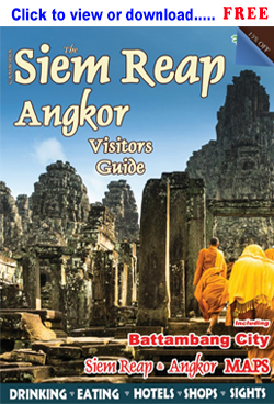
Siem Reap
Maps
The main body of Siem Reap town stretches about 3-4 km north/south along the river and roughly 5-6 km east/west along National Highway #6. The airport is 6km and 20-30 minutes west of town center. The Angkor Park entrance lies 5km north of town center and there are no hotels within the park. Most tourist services are in or near town and are spread relatively evenly across the area, though there are a growing number of hotels at the outskirts, often offering a more tranquil setting. In town, popular areas include: 1) the Old Market/Pub Street area is the tourist epicenter, tightly packed with cafes, hotels and shops; 2) budget and mid-range places in the Wat Bo, Taphul Village and the Sok San Road areas; 3) dozens of hotels along ‘Airport Road’ and the road to Angkor; 4) a large variety of mid-range hotels, restaurants and shopping lining Sivutha Blvd through town.
Map
of Siem Reap Town - This map covers the main body of town. It does not
cover of the temple area or the outskirts of town. This is probably the
most helpful map for ordinary day to day use in town.
Old Market Area - Stretching from the river to the night markets on Sivutha Blvd, the ‘Old Market area’ including Pub Street, the Pub Street alleys is the dining, shopping and nightlife center of town. Once you are there, everything is within walking distance. Nearby, both Sok San Road and the Hup Guan Street ‘Kandal Village’ are growing. Sok San Road now has dozens of budget-friendly business, guesthouses, bars and restaurants, and Hup Guan Street is seeing a growing number eateries, bars and boutique shops.
Tonle
Sap Lake Map - Cambodia’s Great Tonle Sap Lake sits only 15 km south of town, a unique eco-system and cultural area offering the opportunity to see a different side of the Siem Reap - floating villages, cultural and nature tours, birdwatching...
Western Cambodia: Remote Temples - A detailed road map of Western
Cambodia noting the locations of remote Angkorian-era temple ruins such
as Sambor Prei Kuk, Koh Ker, Banteay Chhmar and more.
Siem Reap
Province (2003) - Basic map of Siem Reap Province with district and commune
borders and district names.
Overland Travel: Bangkok -
Siem Reap - Phnom Penh - Schematic map of route
and prices of overland travel from Bangkok Thailand to Siem Reap
Cambodia via the Aranyaprathet/Poipet border crossing.
Angkor and other Khmer Ruins
Maps
The Angkor Archaeological Park is home to the temple
ruins of Angkor, including Angkor Wat, Bayon and dozens of other ancient
ruins of the Angkorian-era (9th-13th century) Khmer Empire. The Park
encompasses more than 400 square kilometers just outside Siem Reap City
in northwestern Cambodia. The ruins of Angkor within the Angkor
Archaeological Park represent the remnants of the millennium-old
Angkorian-era capitals of the ancient Khmer Empire. Most of these
temples within the Angkor Archaeological Park were constructed between
the 9th and 12th century A.D. and represent the pinnacle of ancient
Khmer architecture.
Angkor
Archaeological Park: Greater Park Area
Map - This map covers main temple area north of Siem Reap town as well
as the greater area south to the Tonle Sap Lake and east to the Roluos
Group. It does not
cover Banteay Srey, Phnom Kulen and other distant temples.
Angkor
Archaeological Park: Main Park Area
Map - Most popular temple map. This map covers main temple area north of Siem Reap town
including the grand and petite temple circuits. Insert maps of
Central Angkor Thom and the Roluos Group.
Angkor
Archaeological Park: Central Angkor Thom Area
Map - This map covers main temple area within the ancient walled city
of Angkor Thom inside the Angkor Archaeological Park, including
the Bayon, Baphuon, Phimeanakas, Terrace of the Elephants, Terrace of
the Leper King, Prasat Suor Prat and more.
Koh Ker: Main Temple
Area - Map of the temple complex of Koh Ker in Preah Vihear
Province.
Sambor Prei Kuk: Main
Temple Area - Map of the temple of complex Sambor Prei Kuk in
Kampong Thom Province.
Western Cambodia: Remote Temples - A detailed road map of Western
Cambodia noting the locations of remote Angkorian-era temple ruins such
as Sambor Prei Kuk, Koh Ker, Banteay Chhmar and more.
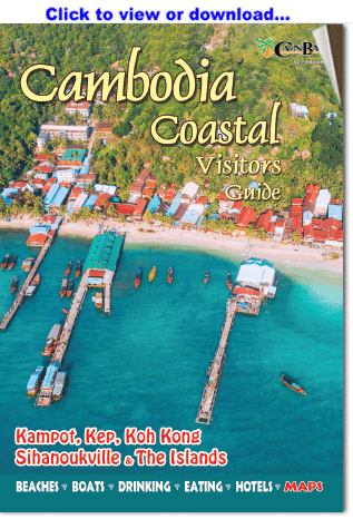
Sihanoukville
Maps
Sihanoukville sits on the southwestern coast of Cambodia. The town area is spread thinly across a 5km wide peninsula jutting into the Gulf of Thailand, rimmed with sandy beaches and the area is a bit hilly. The downtown is near the center of the peninsula a couple of kilometers from the beaches. The bus station is 3km north of downtown and 1km from Victory Hill. The airport sits 18km north of town. Moto-remorques (tuk-tuks) and motodups (see pg 47) are the usual form of transportation and very easy to find. (The city has also recently changed some street names, especially in the Ochheuteal area, and added numbers to most of the streets.)
Map
of Greater Sihanoukville - This map covers the main body of town, the
main beaches, outlying beaches and the outlying area. This map does not
provide detail of the downtown area and covers a bit more area than
necessary to the average beach-goer.
Sihanoukville
Downtown Map - The Downtown Area sits central on the peninsula, about five minutes from the beaches in both directions. A fairly compact area, the downtown is only about two kilometers wide with most of the bus-inesses strung along Ekareach Street and a couple of blocks either side. Several lower mid-range hotels and guesthouses, and bars and restaurants dot the area, as well as convenience stores, the main market, banks and pharmacies.
Victory Hill area - This map gives detail of
Victory Hill (a.k.a. Port Hill, Weather Station Hill, The Hill) streets and
business locations.
Ochheuteal and 'Serendipity' Beach Area Map - Ochheuteal Beach is by far the most popular and touristed beach in town - long and comparatively narrow, with ‘Serendipity Beach’ at the arcing northern end. The beach restaurants that line Ochheuteal typically offer umbrellas and beach chairs, full bars and food.
Otres Beach Area Map - Otres Beach is the next beach south of Ochheuteal, further from town and somewhat more thinly touristed, offering a more relaxed, chill-out atmosphere, especially at the far end of the beach. Beach shacks and guesthouses/bungalows line the near (Otres 1) and far (Otres 2) ends with the central section now public park and a long open tranquil beach without any restaurants, umbrellas or vendors..
Island
Map: Islands near Sihanoukville
- Map of islands in the Sihanoukville area. A side destination from Sihanoukville just a couple of years ago, the islands of the Koh Rong Archipelago have become destinations in their own right. Set in the turquoise-blue waters of the Gulf of Thailand 30-50 minutes off the Sihanoukville coast, the two big islands of Koh Rong and Koh Rong Sanloem are the most popular.
The
Coast of Cambodia
- The coast of Cambodia from Thailand to Vietnam.
Covers Koh Kong, Sihanoukville, Kampot, Kep, Kampong Trach, islands and
border checkpoints.
Overland
Travel: Southern Coast - Schematic map of overland travel routes
from border to border across the major towns of coastal Cambodia.
1958 Sihanoukville - 1958 city map from ministry
publication Kampong Som: Port of the Future.
UNTAC (1993) Sihanoukville - Hand drawn town
map from the UNTAC period.
Municipality of Sihanoukville - Map (2000) of the former
Municipality are of Sihanoukville. The same area has since changed
to the 'province of Sihanoukville.'
Islands Maps
Island
Map: Islands near Sihanoukville - Map of islands in the Sihanoukville area. A side destination from Sihanoukville just a couple of years ago, the islands of the Koh Rong Archipelago have become destinations in their own right. Set in the turquoise-blue waters of the Gulf of Thailand 30-50 minutes off the Sihanoukville coast, the two big islands of Koh Rong and Koh Rong Sanloem are the most popular.
Island Map: Koh
Rong - Zoom in on the island of Koh Rong, the largest and most popular island off the
coast of Sihanoukville.
Island Map: Koh Rong Sanloem (Samloem) - Zoom in on the island of
Koh Rong Samloem (Sanloem), just south of Koh Rong Island, the second
largest largest and most popular island off the
coast of Sihanoukville.
The
Coast of Cambodia
- The coast of Cambodia from Thailand to Vietnam.
Covers Koh Kong, Sihanoukville, Kampot, Kep, Kampong Trach, islands and
border checkpoints.
Koh Tunsay
Island, Rabbit Island. A small island with a few rustic bungalows about 20 minutes ojf the
coast of Kep.
Koh Sdach area Group of islands just north of the islands of
Sihanoukville, between Sihanoukville and Koh Kong.
Kampot/Kep
Maps
Kampot City sits along the east side of the Kampong Bay River near
the base of the Elephant Mountains and is of quite different
character from the beach town of Sihanouk Ville. Kampot City is an
old provincial capital of quiet lanes and colonial period
architecture, a bit worn but radiating a quaint, welcoming, small
town ambiance.
Kampot Town (main map)
Kampot Province
Kep Area (main map)
Koh Tunsay
Island, Rabbit Island. A small island about 20 minutes of the
coast of Kep.
Cambodia: Map of the Southern Coast of
Cambodia (from the Thai border to the Vietnamese border,
including the area covering Koh Kong, Sihanoukville, Kampot and Kep)
Cambodia:
Map of Southern Coast in the Bokor-Kampot-Kep area - This map is
helpful in located some of the caves, temples and other sites in the
Kampot/Kep area.
Koh Kong
Maps
Koh Kong City is the capital of Koh Kong province, a comparatively small town sitting on the east side of the Koh Pao River about 10km from the Cham Yeam border crossing with Thailand. Many travelers see Koh Kong only briefly as they pass through on the way to/from the border, but that is changing as the province becomes something of an eco-destination.
Koh Kong City (main city
area)
Koh Kong Province
Cambodia: Map of the Southern Coast of
Cambodia (from the Thai border to the Vietnamese border,
including the area covering Koh Kong, Sihanoukville, Kampot and Kep)
Battambang
Maps
Battambang sits along the Sangker River with the downtown area on
west side. Parks line sections of the riverfront. The eastern
approach to the city on Route #5 is marked by a statue of Ta Dambong
holding bat dambang. Three main north/south roads form the spine of
the business district. Several foreigner-oriented cafes, bars, shops
dot the streets just south of the market. The town is only a couple
of kilometers long and relatively easily traversed by foot.
Battambang City and zoom on Walking District (main city area)
Battambang Province
Province Maps
Cambodia with provinces
Banteay Meanchey
Battambang
Kampong Cham
Kampong Chhnang
Kampong Speu
Kampong Thom
Kampot/Kep
Kandal
Kep
Koh Kong
Kratie
Mondolkiri
Pailin
Municipality of Phnom Penh
Oddar Meanchey
Preah Vihear
Prey Veng
Pursat
Rattanakiri
Siem Reap
Sihanoukville
Stung Treng
Svay Rieng
Takeo
Historical Maps
Asia 1826
Cambodia 1850
(fragment)
Cambodia
1857 (fragment)
Cambodia 1880
(fragment)
Cambodia 1885
(fragment)
Cambodia 1886
(fragment)
Cambodia 1897
(fragment)
Cambodia 1901
(fragment)
Cambodia 1902
(fragment)
Cambodia 1906
(fragment)
Choeung Prey Province,
Cambodia, c. 1880
Farther India 1885
French Indochina 1913
Indo-China 1886
Kampot Province,
Cambodia, c. 1880
Kandal Province,
Cambodia, c. 1880
Kratie Province,
Cambodia, c. 1880
Phnom Penh, Cambodia,
1867
Phnom Penh, Cambodia,
1920
Phnom Penh, Cambodia,
1922
Phnom Penh, Cambodia,
1925
Phnom Penh, Cambodia,
1928
Sihanoukville: 1958 - 1958 city map from ministry
publication Kampong Som: Port of the Future.
Sihanoukville: UNTAC (1991-93) - Hand drawn town
map from the UNTAC period.
Southeast Asia 1626
Southeast Asia 1721
Southeast Asia 1942
|