|
The temple complex at Koh
Ker, northeast of
Siem
Reap, represents the remnants of the capital of the
Khmer Empire from 928 AD. - 944 A.D. - a very unique period
in the
Age of Angkor.
From the time the Khmer capital was first moved to the
Angkor area in the late 9th century, it would remain there
for almost 500 years, with one brief interruption. Just a
few decades after the establishment at Angkor, there was a
disruption in the royal succession for reasons that remain a
matter of academic debate. What is known is that in 928 A.D.
King Jayavarman IV, possibly a usurper to the throne,
created a new capital 100km away at Koh Ker, either
moving the capital city from Angkor or creating a rival
capital. Obviously a king of much wealth and power, he
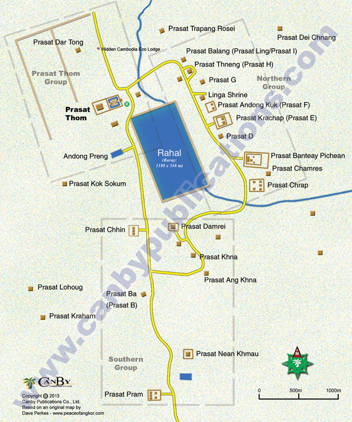
raised an impressive royal city at Koh Ker of Brahmanic
monuments, temples and prasats, surrounding a huge baray
(reservoir) Rahal. Jayavarman IV reigned at Koh Ker
for 20 years before he died in 941 A.D. His son Hashavarman
II would remain at Koh Ker for another 3 years before
returning the capital to the Angkor area. The monuments of
Koh Ker are now on a road loop around the baray past
the most important temples. The premier ruin of the complex
is Prasat Thom, an imposing 7-tiered pyramid and temple
complex. (Best photographed in the morning and offering a
bird’s eye view from the top.) As you round the loop, there
are several nicely preserved ruins sit just off the road,
impressive prasats and small temple complexes. There are
lingas still in place in some monuments such as Prasat
Balang and Prasat Thneng. For the enthusiast,
there are also dozens of other, more remote ruins in the
area. A good guide can be most helpful at Koh Ker. A trip to
Koh Ker takes the better part of a day out of Siem Reap and
is usually combined with a visit to Beng Melea. To get there
take Route #6 east from
Siem Reap to Damdek. Turn north and follow the signs.
Part of the way is a toll road. Check road conditions before
leaving
Siem Reap,
especially in the wet season. $5 entrance fee to Koh Ker.
|